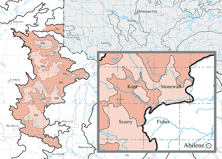
Ecoregion 26b · Flat Tablelands and Valleys
The Flat Tablelands and Valleys ecoregion includes islands of level land between the prominent buttes, badlands, and escarpments of the tablelands. Fragments of remaining native prairie are composed of mid-height grasses, such as sideoats grama and blue grama, typical of a wetter climate. Where the land has been intensively grazed, short grasses such as buffalograss predominate, and invading cacti and honey Mesquite are common. Saltcedars are replacing native vegetation in riparian areas.
Ecoregion 26c · Caprock Canyons, Badlands and Breaks
The Caprock Canyons, Badlands, and Breaks ecoregion covers the broken country extending eastward from the eroded edge of the High Plains. The escarpment at the eastern edge of the Llano Estacado exposes Ogallala Formation sediments, underlying multicolored Triassic shales, mudstones, and sandstones, and Permian red beds with white gypsum deposits that form the plains to the east. The maximum relief along the escarpment is 1100 feet; the combination of topography and climate in this ecoregion creates thunderstorms and tornadoes in the spring and early summer.
Along the escarpments, redberry junipers grow on the rimrock and cliff faces, along with skunkbush sumac, ephedra, mountain mahogany, plum, grape, and clematis. Mohr shin oak and Havard oak are found on the benches and slopes, and honey Mesquite on the flat valley floors. Riparian vegetation includes cottonwood, willow, hackberry, and big bluestem grasses with alien elms and saltcedars. Steep slopes, runoff, and salinity in badland areas limit vegetation to a sparse growth of yucca, cacti, ephedra, or sandsage.