Texas Canyonlands
While this website focuses its special attention on the Brazos River and its table and canyonlands, the site also examines a larger area and larger story of which the Brazos is a part. This larger area encompasses the headwaters of the Red River and the Colorado River as well as the Brazos. This larger area of canyonlands and tablelands, about three hundred miles in length and fifty to one hundred miles in width, lies along the edge of the Texas High Plains, the Llano Estacado. We call these the Texas Canyonlands.
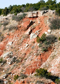
Description-scott_bourland_20071107_252
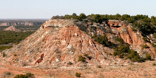
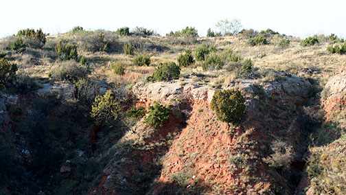
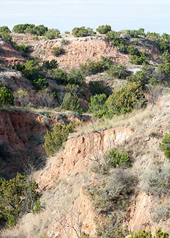
Steep cliffs along the Double Mountain Fork of the Brazos River in Longhorn Valley
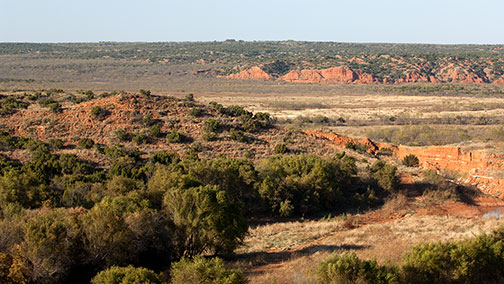
At the north end of the Texas Canyonlands near Amarillo the Red River headwaters create the majestic Palo Duro and Tule Canyons. On to the south, the Brazos River headwaters wind out of Yellow House Draw near Lubbock and out of the Double Mountain Fork Canyon in Garza County, joining as the river enters the Brazos River Canyonlands in Kent County.
Further on south and west along the rim of the Texas High Plains the Colorado River headwaters begin at the “caprock” edges of Dawson and Borden counties, carving out Muchaque Valley and Gail Mountain.
This website relies heavily upon Dan Flores' ideas and information in his books Caprock Canyonlands and Horizontal Yellow. Through his publications, Flores influenced the recognition of this unique land and its formal designation by the USGS as distinct ecoregions.
U. S. Geological Survey
Ecoregions of Texas
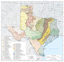
Ecological and biological diversity of Texas is enormous. The state contains barrier islands and coastal lowlands, large river floodplain forests, rolling plains and plateaus, forested hills, deserts, and a variety of aquatic habitats.
The Texas Canyonlands area has been designated by the U. S. Geological Survey as two distinct Level IV ecoregion systems: Caprock Canyons, Badlands, and Breaks and Flat Tablelands and Valleys.
To learn more about the ecoregions of Texas and the Texas canyonlands, use the following links to view a map created by the USGS.
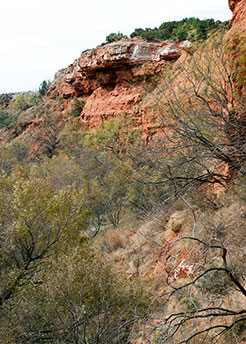
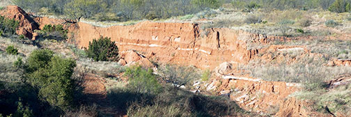
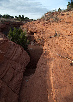
Rugged escarpment plunging into Impossible Canyon
Description-scott_bourland_20071106_051
brazosrivercanyonlands.com is published by Jim Watson and licensed
under a Creative Commons Attribution-NonCommercial 4.0 International License.